
WARNINGS
BVI On High Surf Alert Until Wednesday
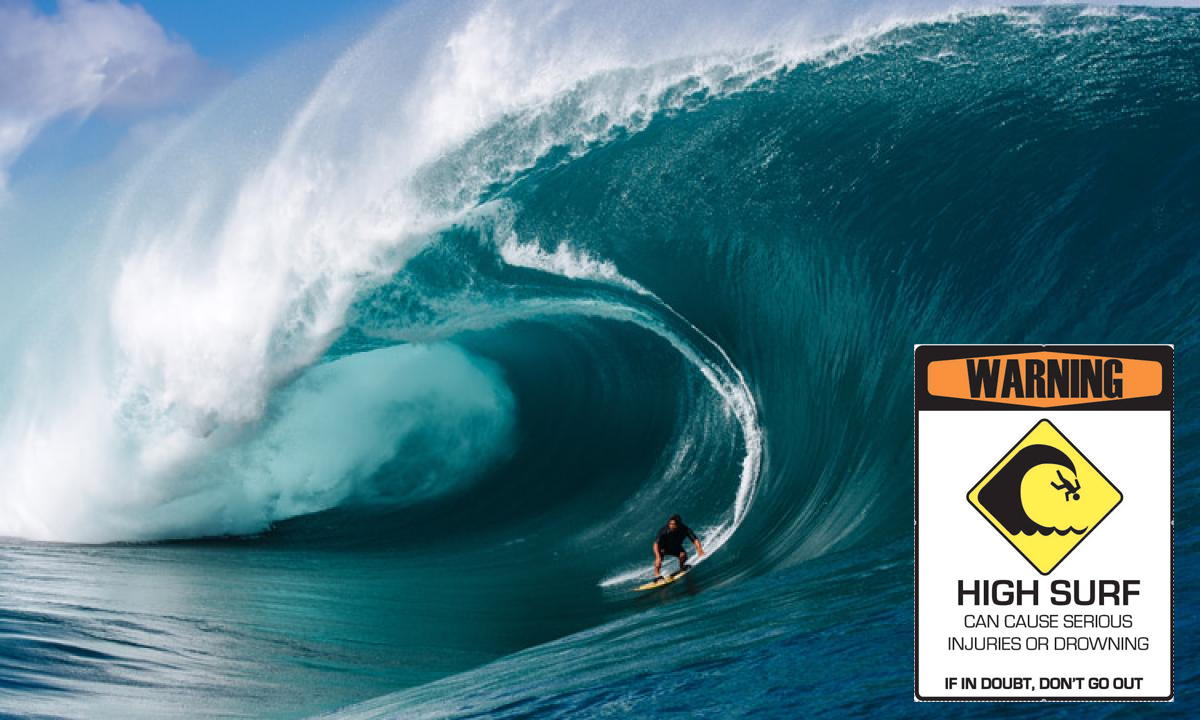
Beachgoers are advised to be cautious this week with dangerous surfs of six to ten feet expecting to hit some coastlines in the British Virgin Islands producing hazardous conditions.
The high surf alert is expected to last until Wednesday, March 29.
The moderate long-period swells are affecting mainly the northern and eastern coastlines of the territory.
“Beachgoers, especially to the mainly affected coastlines, should be extremely cautious; bathe only where lifeguards are present or on the sheltered, less affected beaches, mainly to the south. Extreme caution is also required by those using the affected non-beach or rocky coastlines,” the Department of Disaster Management (DDM) advised in a recent press statement.
According to DDM, the “threat level to the life, livelihood, property and infrastructure of those using the affected coastlines is moderate.”


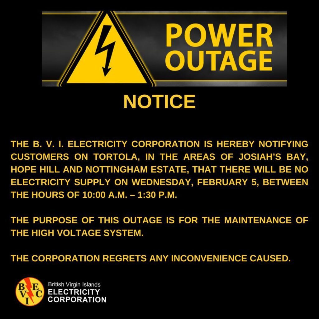
Residents in several communities on Tortola are set to experience a scheduled power outage on Wednesday, February 5, as the British Virgin Islands Electricity Corporation (BVIEC) undertakes maintenance on its high-voltage system.
The affected areas include Josiah’s Bay, Hope Hill, and Nottingham Estate. The outage is expected to last from 10:00 a.m. to 1:30 p.m., according to a notice issued by the BVIEC. Officials said the temporary disruption is necessary to ensure the reliability and safety of the electrical grid.
The BVI Cancer Society has issued a warning to residents about a concerning scam circulating on WhatsApp, where fraudsters are misusing the charity’s name to deceive members of the community.
“We have received multiple reports from community members who were contacted by individuals falsely claiming to represent our organisation,” the society said in a statement.
According to the reports, the scammers have been inviting individuals to Zoom calls and making false claims related to the charity’s Bingo fundraising events. “This misuse of our name is deeply concerning, and we are committed to ensuring the public is informed and protected,” the statement continued.
The BVI Cancer Society clarified that it does not use WhatsApp to send invitations to Zoom meetings or to promote events. Official information about its activities, including fundraising events, is shared exclusively through verified channels such as its website, Facebook page, and trusted community partners. The organisation also stressed that it never requests personal information or financial contributions through WhatsApp.
The society urged the public to remain cautious. Anyone receiving suspicious messages claiming to be from the BVI Cancer Society is advised to avoid clicking on links or sharing personal information. Instead, they should contact the society directly to verify the legitimacy of the message. Reports of such scams should be made to the Royal Virgin Islands Police Force by dialling 311 and providing details of the suspicious contact.
“We are deeply troubled that scammers are exploiting our name and reputation in this way,” the society said. “Our focus remains on supporting the community through cancer awareness, prevention, and care, and we ask for your assistance in stopping this fraudulent activity.”
For further concerns or information, members of the public can reach the BVI Cancer Society at 1284-499-0022 or via email at bvicancersociety@gmail.com.
As the festive season brings increased consumer activity, the British Virgin Islands Bank Association (BVIBA) has issued a stern reminder to merchants across the territory regarding compliance with card transaction policies.
The association warns that imposing minimum spending requirements or charging additional fees for card payments is not only against their merchant agreements but also violates regulations established by major payment networks, VISA and Mastercard.
The advisory, issued on Wednesday, December 18, warns that merchants engaging in these practices are in breach of their contractual obligations with their respective financial institutions. “We request that all merchants immediately cease these practices to ensure compliance,” the statement read.
The BVIBA comprises several prominent financial institutions, including Bank of Asia (BVI) Limited, CIBC Caribbean, FirstBank PR, National Bank of the Virgin Islands, Popular, Republic Bank (BVI) Limited, and VP Bank (BVI) Limited.
For inquiries or guidance on compliance, the BVIBA advises merchants to contact their respective banks promptly.

BVI U19 Rugby Squad Departs for Dominican Republic Development Tour

British Virgin Islands Regulators Move to Wind Down Bank of Asia (BVI) Limited

Minister Rymer Briefed on Airport Infrastructure Enhancements


-

 Crime/Police2 weeks ago
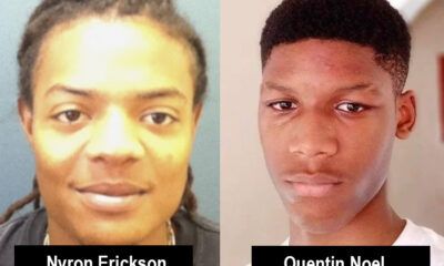
Manhunt Underway for ‘Small Brent’ in Nyron Erickson Murder Case
-

 Local News2 weeks ago
Controversial 3-Point Call Proven a 4, But Result Stands: Team USVI Withdraws from Third-Place Match
-
 Uncategorized2 weeks ago
Festival Costs Outpace Revenue Despite $1M Intake, Says Premier
-
 Uncategorized6 hours ago
British Virgin Islands Regulators Move to Wind Down Bank of Asia (BVI) Limited
-

 Entertainment1 week ago
Five Students to Compete in Mr. & Miss HLSCC Pageant on June 1
-

 Uncategorized4 days ago
Chantel Malone Leaps to First Place Amid Headwinds at Tucson Elite Classic:
-

 Local News2 weeks ago
King’s Baton Officially Handed Over to Premier in Ceremony Ahead of 2026 Games
-
 Crime/Police2 weeks ago
Deputy Commissioner Confirms 17 Gun Robberies, Two Fatalities in 2025